
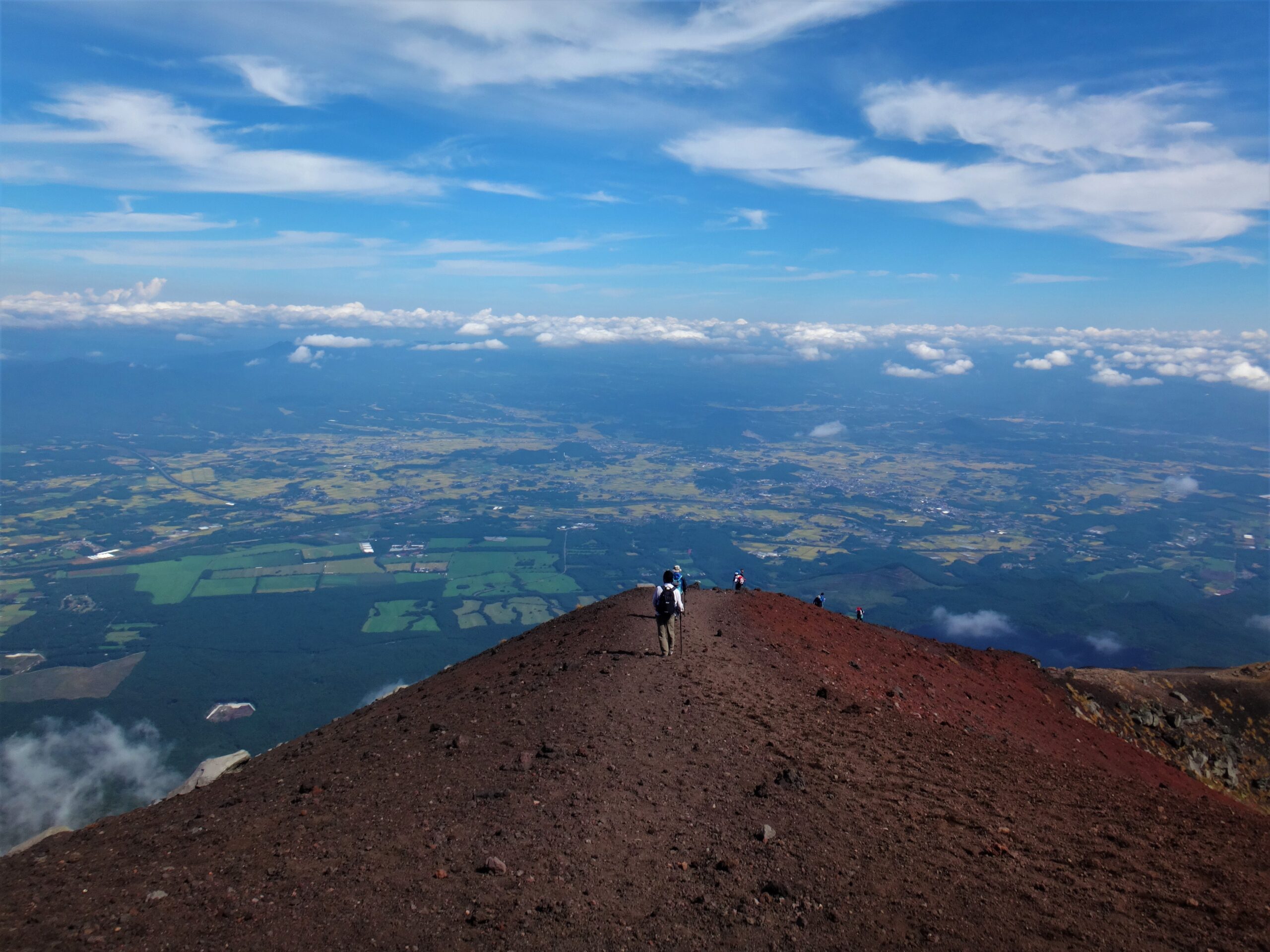
Mount Iwate (2,038m) rises above Morioka in a near-perfect cone that earns it the nickname “Nanbu Fuji.” It has been a sacred mountain for centuries, and the old pilgrimage route up its eastern flank is still the most popular way to the summit. It is also an active volcano, and access to it changed in July 2026 — so before you plan anything, start with the current status below.
Current access status (as of 2026-07-19)
Mount Iwate is at Volcanic Alert Level 2 (restrictions around the crater), which Iwate Prefecture reports is being maintained. Under that level, access is partial rather than open:
- Open: the four eastern routes to the summit reopened at 6:00am on 1 July 2026 — Umagaeshi (Takizawa City), Yakehashiri and Kamibou (Hachimantai City), and Omisaka (Shizukuishi Town).
- Closed: the western side of the mountain remains under an access restriction because of elevated volcanic activity.
Volcanic conditions can change at short notice, and an alert-level change can close a route with little warning. Check the Japan Meteorological Agency volcano page and the Iwate Prefecture climbing notice before you travel, and follow the regulatory signs at the trailhead on the day.
What the prefecture asks climbers to do
Because this is an active volcano, the safety requirements are not optional formalities. Iwate Prefecture asks climbers to:
- Submit a climbing notification and a descent notification (tozan-todoke / gezan-todoke).
- Carry a mobile phone that can receive volcanic emergency alerts — this is how a sudden change reaches you on the mountain.
- Follow the on-site regulatory signage, which reflects the current restriction rather than any map you brought.
- Take bear precautions (a bell, whistle or radio) — this is bear country.
- Plan for heat in summer: carry enough water and take regular breaks.
The Yanagisawa Trail from Umagaeshi
The Yanagisawa Trail, starting from the Umagaeshi trailhead at 633m in Takizawa City, is the classic route and the one most visitors take. It is roughly 11km round trip with about 8 hours of walking, climbing around 1,400m to the 2,038m summit — a full day rather than a casual hike, and steeper than the distance suggests.
Above the Second Station the route splits: an old forest path, or a rockier line with open views back over Morioka and the Kitakami Mountains. Both rejoin higher up. From around the Fifth Station in June and July, the alpine flowers along the old path are one of the reasons regulars keep coming back. The trail follows the route mountain worshippers have used for centuries, which is part of its character.
Getting to the trailhead
Umagaeshi is about 40 minutes by car from Morioka Station, and there is a free car park at the trailhead. Buses run from Morioka toward Umagaeshi, but services are limited and do not suit every start time — check the current timetable before relying on them, and have a plan for the return leg after an eight-hour day. Morioka itself is straightforward to reach by Tohoku Shinkansen; see our Japan transport guide for rail passes and Shinkansen practicalities.
When to go
Like many northern peaks, Mount Iwate is a summer-to-autumn climb; snow lingers into early summer and returns early. Start at first light if you are doing the full round trip, carry layers because conditions at 2,000m change quickly, and turn back rather than pushing a late summit. Autumn brings colour to the lower slopes and cooler walking, but shorter daylight — plan the descent time carefully.
If the mountain is closed, or you want an easier day
Restrictions can rule out the summit at short notice, so it is worth having a second plan. Morioka Castle Park is an easy walk in the city itself, Geibikei Gorge offers a boat ride through cliffs, Chuson-ji is the region’s great temple complex, and Jodogahama is the standout stop on the coast. Our Iwate travel guide puts these in a route.
A working data connection matters more than usual here: emergency volcanic alerts, timetable changes and weather updates all arrive through your phone.
Sources checked: Iwate Prefecture notice for Mount Iwate climbers, Japan Meteorological Agency volcanic activity information, and National Parks of Japan: Mount Iwate Yanagisawa Trail. Checked 2026-07-19. Volcanic alert levels and trail restrictions change — always confirm the current status with the official sources before you climb.